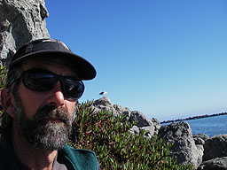
Wednesday, November 30, 2011

Off to Mexico again

It looks like we'll go to Mexico earlier than we were figuring. My recent PET scan shows tumor activity, and my oncologist recommends I start chemo again within three months at the outside. We had planned on a March trip to the Sea of Cortez but we have moved it back to ASAP. So of course we had another bummed out Thanksgiving. And it kinda puts a damper on Christmas. But heading to the beach perks me up! Basically, Valdesca is ready to go, except for some modifications I need to make to her new cushions (which I made this fall but goofed up).

Beyond the cushions, there's not much else to get ready. This is kind of push button now. Of course, I need to get our Mexican fishing licenses and Mexican vehicle insurance. And our Mexican entry cards. I have to shop for food and supplies. We'll stop in Tucson and get the outboard tuned up. No bottom paint this time. And no new paint on the deck boards. We gotta get.  Fortunately, we have our super-duper trailering cover. Check it out.

I probably already posted that, but I'm STILL proud of it!

Getting ready for Christmas, I wanted to send out some DVDs of our sailing videos, which made me get back to work on our summer 2011 Maine video. The video is embedded below and here is the youtube link.


I didn't take very many photos at Lake George this summer, meaning I am not going to have much to show from that trip. My sister Jean was the shutterbug so I gave myself a week off.

The idea this year for the Sea of Cortez is to trailer Valdesca to Bahia San Luis Gonzaga and sail from there. We would like to be near a place where access and egress is relatively easy in case we have to head back home in a hurry. There are islands off the coast that we can visit. We can sail both up and down coast depending on what the weather deals us.


Saturday, October 22, 2011

Texas

I was reading an article in a geology journal today about rising sea level  and predicted impacts on the coast of Texas. I've been trying to get Tim to sail there with me in Valdesca but he's not interested in the Redneck Riviera. A propos of the article I was reading, I commented, "We'd better sail the coast of Texas before it gets inundated by rising sea level." Without a second's pause, he replied, "You can sail the coast of Texas at ANY sea level." Guess there's no hurry...

Tuesday, July 12, 2011

Lake George!

Our stay at Lake George has come and gone. Great weather, great winds, great sailing. Here are a few photos. More later.

Thursday, June 30, 2011

St Louis!

After 14 hours of driving, we've arrived in St Louis, staying at my sister Anne's house. Weather here is about 100 degrees and 97 percent humidity, quite a change from NM. Mosquito factor about the same.

Panhandle


It's 8:30 Oklahoma time and we're at Denny's. It's a food desert out here. I asked the host what kind of coffee options they had. And he told me, "Coffee. And diet coffee." So here we are.

We drove until 11:30 last night. Made about 350 miles and pulled off I-40 between "Claude" and "Goodnight." Slept by the side of a side road, next to an old shack and some grain hoppers. Crickets chirping. Swallows swooping. Woke up at first light to wind. Oh boy. It's going to be windy again today.

We'll drive as far today as we can, maybe 10 or 12 hours. Should get to St Louis at least.

Last night we pulled off the road at San Jon (curious name) to get gas and eat dinner, which we had brought with us. We sat there in the fading light, watching the LED sign at the San Jon Community Center advertise again and again the 4th of July softball tourney and fireworks. We had the best dinner in San Jon, I am certain: organic butterfly pork chops in a lime and cilantro marinade with zucchini, yams, and russet potatoes, Little Gems lettuce from our garden, fizzy water, and green tea mints. I went into the quick mart after dinner and saw a kid swabbing the decks. He wouldn't make eye contact. There was a low shelf full of big stuffed animals. The lions' paws and tails were laying on the floor. I watched the kid swab the mop right over them. Tim mocked, "I hate this town! I'm gonna get outta here as soon as I can. I'm goin' over to that other town where they at least have bars!"

Wednesday, June 29, 2011

Baby giiiiiiiiirl!


Tim says, "That'll be a sight for sore eyes in the rear view mirror!"

We're off, in a cloud of fire smoke

Today's the day. We're leaving hot, dry, smokey New Mexico for the East Coast. The Las Conchas fire zapped our ganas a little and slowed up our departure. We have had evacuees from Los Alamos staying here with us. For Tim and I, this is deja vu, having evacuated from Los Alamos ourselves during the Cerro Grande fire in 2000. Despite it all, however, Tim replaced the trailer lights yesterday, we tried on the new boat cover, and now we can load and flee.

We are heading to Lake George New York for a week of sailing and having fun with family. We are all renting a big place at Huletts Landing for my father's 90th birthday. After that, we are taking Valdesca to the coast of Maine for three more weeks of sailing. We are really looking forward to seeing old friends and sailing to places I remember from my 'yut.'

We'll keep you posted on our doings. Those of you on our SPOT tracker list will receive daily SPOTS so you will know right where we are.

Thursday, April 28, 2011

More snippets

Mar 17

Started at 12:15 PM from Santa Rosalia. Peter rowed. Sailed a bit. Wind died. Then motored. Passed Punta Bufechero and anchored at the second beach, a clean gravel beach. This is where we encountered the osprey last year. No ospreys sitting on the nest now. Though there are nestlings just over the ridge; we heard them early this morning. Next beach up, Jane says, is a mess of garbage. Anchored in about 10 ft of water, many big rocks. Did a clothesline. We were swimming this last year.

Valdesca handles well despite the load. Four people, gear, supplies, and water for at least 5 days. We all did the shopping and packing. Tim took the car to San Bruno and returned in <1 hr.

San Marcos has so much life. Yellowtail rounding up mackerel. Pelicans diving, seagulls chattering, osprey fishing and calling to nestlings, dolphins, sea lions. More life than we have seen elsewhere. Tidal currents apparent around Punta Bufechero.

Mar 21  Caleta los Pilares
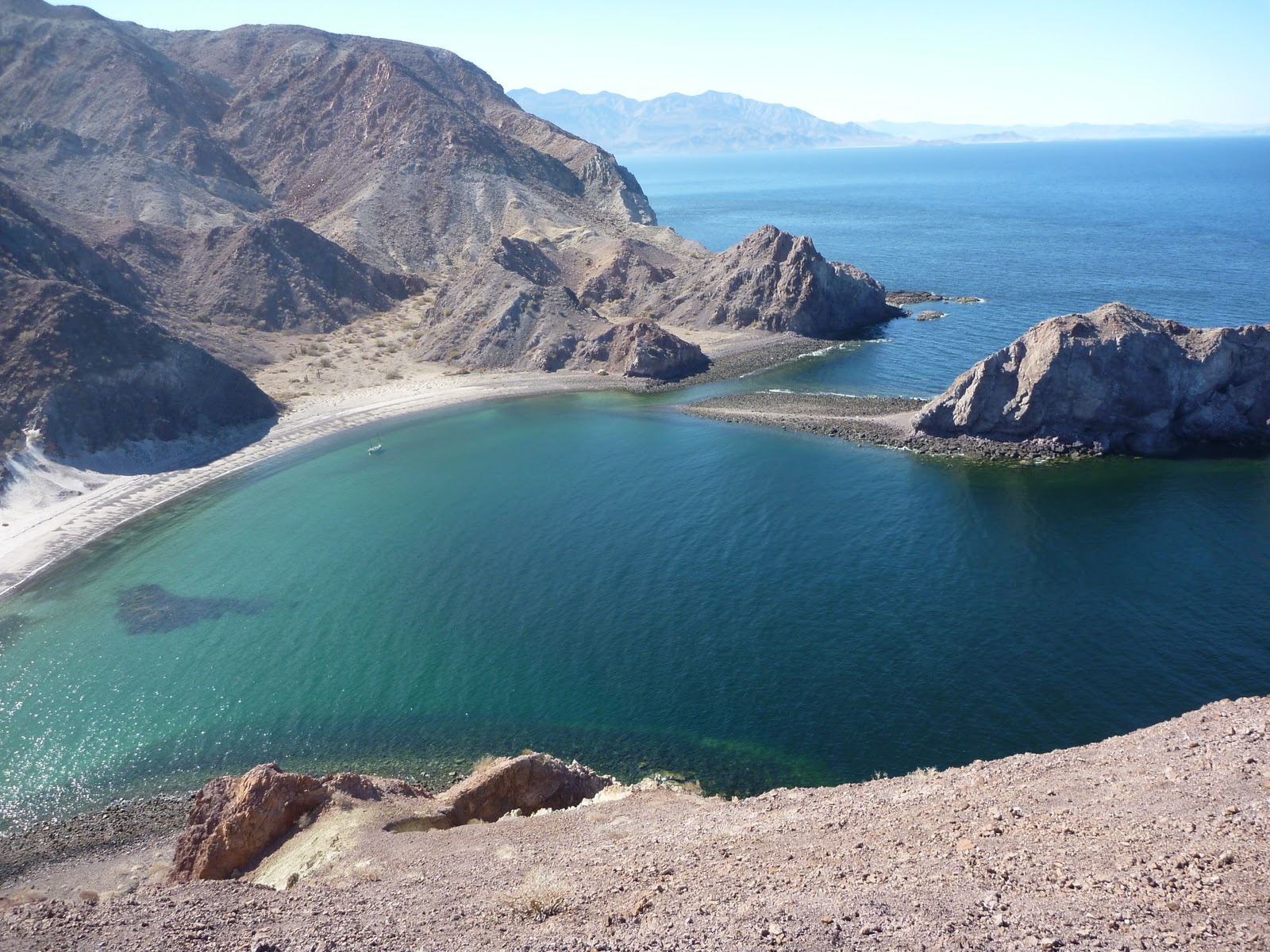
Tacking back and forth into easterly-southeasterly, then up comes a big blow from the SE. We turned “a pata” and went back 4 miles to Caleta los Pilares, where we anchored and camped. I visited the abandoned Gavilan manganese mine with Jane near dark. Found some nice chunks of ore. Beautiful hour to be out and about. 

Mar 22  Below Bahia San Lino
Sitting out another blow, with Peter pacing up and down the beach wanting to sail. Tim and I are perfectly happy to stay on the beach. Hard to reconcile. We just aren’t hairball sailors. And four of us are safe on the beach. Wishing we’d stopped at Punta Colorado. Tim and I would have, had we been alone. Nice place to stop, after 16 miles, and assess the situation. And sit out the westerly that was gusting until dusk yesterday and now this norther, neither of which were predicted by buoyweather. As Roger Marin (sailing director at NOLS) told us, you have to do this stretch in good weather because it’s committing.

Missed the call on this norther. I don’t know what signs we didn’t see, or what signs we misinterpreted. No mares’ tails streaming from the N. No barometric fluctuations. We did have the north wind yesterday afternoon, perhaps a precursor. And the calm last night after a big huff around dusk. There was some cloud cover in the north but not persistent; it came and went like we’ve seen other times with cloud cover in the south and clouds that move in from the west. There was the cool, vapor-laden wind last evening. Until dusk, a westerly was pushing the light, northerly gradient wind out into the sea. Really, we didn’t have much to go on. I guess this is one of those northers people get “caught” in. I’ve always thought they were likely to be predictable. I guess ANY wind from the north should be regarded with deep suspicion.

We had a southerly the other day that seemed to come out of nowhere, too. After tacking endlessly upwind in a moderate southerly, the wind amped up and came at us like a wall. We were looking south at the whitecaps. And two sailboats headed north were reefed. One had a storm trysail, looked like, and a storm jib. The other had a furled jib alone.

Yesterday, during the westerly, we saw a cruiser go by, heading south, ghosting along on a mainsail before the wind. No jib. Then, the boat passed into the zone of westerly wind and changed to a starboard tack, spilling a lot of wind from the main. That told me the westerly gusts were significant.

Today, there are no boats about. No cruisers. No pangas. Everybody is sitting tight. Of course, the fishermen don’t catch much on a day like this. Or they fish the few calm spots around, of which there aren’t many here.

Tim hiked out to the lighthouse earlier this morning. Didn’t see much hopeful in terms of better anchorages. The way to go, if we decided to leave this beach, would be to go way out and sail far. The landings are the problem, though, no matter if you land nearby or far away. Tim said Caleta San Sebastian looked hellish for a landing. There were huge rollers sweeping down the coast, which would make it tough to hit that tiny slot, especially with the shoals on the south side. We already know of one sailboat that came to grief on those shoals not too long ago.

We are about mid-tide now, at noon. Either the tide will keep flooding slowly until early tonight (if the tides here are like Santa Rosalia) or it will go slack for a while and then flood some more (if, on the other hand, the tides here are like Loreto). In any event, it will rise another 40 cm. We have to keep the boat in as calm a spot as possible by adjusting the anchor rode. Tim thinks Punta la Laguna (last year) was much worse—a steeper shore, a bigger break, and Valdesca was dragging her anchor. So far, no dragging. We’ll see with higher water.

I should never have relaxed on my tidal vigilance. Tides obviously still make a big difference. And protection from north winds should always be considered—and found! Obviously, those winds can appear out of a blue sky.

I think after this, we’ll pull the boat wherever we drop off Pete and Jane. We can go to Bahia Concepcion and sail around there with a light load. That would be fun. Neither of us needs to do more miles.

Tim is back and says Medano Blanco surf is worse than this beach. There was a marginally protected cobble beach at the N end of Medano Blanco that looked possible, but not easy to get into. The landings more than the sailing are the bight (haha—bite!).

It’s warming up here in the sun. Wind continues unabated. But not amping up either. We seem to be down to five waves off the beach, not seven. Maybe the surf is laying down a little. There’s a sandbar taking most of the hit. Valdesca is riding behind the bar. Another Hawaii 5-0. If you just wanted to be at a beach, you’d be pretty happy with this one. Beautiful colors—marine blue, emerald, olive green, white, and the cream-colored sand. Looking out, as far as I can see, there is nothing, just water.

The wind has shifted some this morning—from NW to N. Now the wind is perpendicular to the waves. This morning the wind was driving the boat down beach. That means the wind is veering, not backing; a good thing.

I wonder what caused that westerly yesterday? There is a topographic low in the peninsula. Maybe just hot air rising over the mountains of the peninsula and then collapsing as the sun passed its apogee. Hard to imagine Pacific air being so hot as that westerly wind.

Platoons of pelicans flying over, in long lines and vees and double vees of 25 or more birds. They soar over the point to the south. A big lift there, I guess, which means wind sheer.

Jane’s question: “Why is the weather so extreme here?” That’s a good one. Desert next to sea. Desert peninsula with cool bodies of water on both sides: Pacific Ocean and Sea of Cortes.

Mar 24  Caleta San Sebastian
Anchored in the cove at San Sebastian, same as last year. Tim and I are lounging beneath the tarp. Jane and Peter are off negotiating purchase of their Baja casita. Jane likely trying to commit their resources to a house and boat down here before Peter buys the blue water sailboat.

We’ll take out here and go to Concepcion Bay for a few days. Eat empanadas and shrimp. See Tap and Anita. Maybe sail to some places where I’d like to see geology—Arroyo Amolares, south end of the bay, Isla Requeson. There will probably be some room for us on the beach at Playa Coyote as it’s late in the season and many people by now have gone north. 

I guess I need to write a book on seat-of-the-pants weather prediction in Baja with caveats about internet sites like buoyweather. This past week, they didn’t hit it once. No prediction of southerly blow. No westerly. No northerly blow. Winds were supposed to be from the SE no greater than 12 knots during the first half of the week and from the NW no greater than 12 knots the rest of the week. Copacetic! Not.

There is really no substitute for experience. We have been keeping track of our observations, predictions, and outcomes. We’ve also learned to leave nothing to chance and to be conservative.

We’ve developed some useful cut-off times for wind and weather. If it’s windy before 8 AM, it will build. Gradient winds kick in by 10:30. Get your traveling done early; get to a protected cove by noon, or plan bail-outs in case weather goes foul en route to a distant, wishful goal.  At dusk, some winds lay down. Some northers start cranking at 3 AM. Westerlies typically start after noon. Local, katabatic winds can displace gradient winds until gradient winds get strong enough to wipe out the topographic winds or the topo winds die (i.e. at dusk).

If a norther dies out mid-day, that’s usually the end of it. Usually. Yesterday, N wind died by 3-4 PM but picked up again today.

We’re trying to make some general observations about El Niño/La Niña years. Northers are more intense and of longer duration in El Niño years.

Here are some maxims that seem to apply down here.
If the birds are flying, the wind is not intense. If the birds are hunkered down, big wind.
First rise after a low signifies a stronger blow.
Mackerel sky, mackerel sky; not long wet, not long dry.
Red sky at night, sailors delight. Red sky at morning? Mostly useless. Red every night and every morning here.

Often get mares’ tails and mackerel skies coming in from the west that don’t amount to anything. The more organized the pattern, and the more persistent, the more likely it means something. Recall mare's tails and other clouds from all directions at La Reforma. Meant nothing.

Spreading out of contrails in the direction of the upper winds. Useful.

Carry a watch-mounted compass. Keep a log and pen handy. Note times and observations, especially changes.

Distances are huge in Baja. It’s easy to underestimate the size of seas from a quiet cove. Use binoculars. Look for “dragon’s back” wave trains on the horizon. Observe pangas. Are they pounding? Observe sailboats. How much sail are they carrying? Are there even any boats about? When are boats about? Only a couple of boats really early? Lots of sports fishing boats? These observations can really help. Bigger boats often have more information. People coming from towns often have more information.

Mar 26  Caleta San Sebastian
Tim has gone for the car and trailer. He left at 8:30 with Peter, Jane, and Pete, who owns a house here. Tim will hitch to San Bruno from the intersection with Hwy 1. It should take him 5-6 hours, if he gets a ride pretty fast. He’ll get back here no earlier than 2:30 PM. We’ll pull out here (lots of help offered by folks here), and go to Concepcion Bay. We’ll sail there a few more days. Hopefully, we’ll have wind.

1:20 PM, wind blowing hard from the northeast, spilling into the cove. It’s likely 20 knots out there. It started blowing March 21 with a light breeze from the SE. Then, on March 22, it was still in the morning, with a light breeze from the NW in the afternoon. At dusk, the wind from the NW picked up but dropped off during the night. On the 23rd, it blew hard from the NW-N. On the 24th, the wind laid down somewhat during the night but started to amp up over the course of the morning, dwindling by about 3 PM. On March 25, a good breeze picked up in the morning, by 8:30, which then amped up during the day and veered to the N-NE. This wind died at night. On the 26th, the wind kicked in early and blew pretty strongly over the course of the morning, blowing about 20 knots by noon. So it has been blowing hard from the north since 3 AM on March 22, four days of northerly blow.

Sitting under Pete’s palapa reading “Baja’s Hidden Gold” by Herman Hill. Hill is a prospector who apparently still lives in Bahia de los Angeles. He notes that he has always worked alone. He can set his own limits and find his own preferred mixture of risk and reward. He likes the special bond he develops with the desert when he is alone. He is free of distraction to try to become one with his surroundings, to assimilate himself into the realm of nature.

Pacific NW Sailing on Valdesca

Wednesday, April 27, 2011

Drascombe longboat "Valdesca" Sea of Cortes Mexico

Snippets


April 4   Erendira
Last night we stayed in the village of Erendira on the Pacific Ocean. Impressive surf. Huge swell. Crashing tons of water. We decided we didn't need to travel this stretch in Valdesca. This morning, two cups of coffee each and we’re off for the border. This area is green green green. Fields of cauliflower and artichokes. Dinner last night was quesadillas, left over from lunch, and margaritas.

North of Ensenada and south of Rosarito, flying along on the toll road, we passed Baja Film Studios (AKA Fox Exploratorium). I looked them up later and realized that "Titanic" was filmed there, as was "Master and Commander: The Far Side of the World." They have a 20-million-gallon tank and 2000 ft of ocean front. The director of "Master and Commander" effused, "The Baja Tank was our Pacific and our Atlantic, our Brazilian Coast and our Galapagos Islands."

As we ogled the studios on our way by, we missed our turn-off to Tecate, nearly causing me to blow a gasket at the next toll booth, in Rosarito. These tolls are not cheap. We had to pay something like $5 to get off the toll road having paid $7 to get on it. And we were just going to turn around and go the other direction. But the guy at the toll booth didn't care and made us pay the toll. He did give us directions on how to get to the free highway to Tecate, which is what we were looking for. In my annoyance, I didn't pay close attention to the directions he gave me and we ended up right back on the toll road, going in the other direction, heading for a toll booth, where we were going to have to pay the toll again. When we got there, I waved our receipt from 5 minutes before, and told the guy we had made a mistake and wanted to get on the free road (in Spanish, mind you). He gave me the directions on how to do it. And then he asked me, "So what do you want?" I told him, "I don't want to pay again!" Without another word, he locked his register and marched back to the cars lined up behind us and started directing them to move to another lane. With horns honking behind him, he directed Tim to back the boat up and then moved a pylon for us to turn around. 

Headed north once again, we took the Rosarito exit and then the (badly labeled) turn for Bajamar (the free road), and then... To find the left turn to Tecate we had to stop at a store and ask where it was. We were looking for MEX-2, indicated in my 2009 Baja California Almanac.  But apparently that road, since 2000, is called the Corredor Tijuana-Rosarito. And, it turns out, you cannot access it from the toll road. You have to know that in advance and exit the toll road 6 miles south of the Corredor or pay the toll and backtrack 7 miles. I found this online, from someone who had a similar problem in 2006,  "At that time, the entire road was finished except for the final interchange in the southwest with MEX-1D, in southern Rosarito, near the FOX Exploratorium Studios. At that time, one had to take a badly signed detour road carved through the hillside, where you joined free MEX-1 through the city, before you could enter MEX-1D [MEX-2 in my almanac]. I do not know if that interchange has been completed as of now, but road projects in Mexico usually take a very long time to complete." A very long time... It's been like six years.

Once we were on Corredor Tijuana-Rosarito (which means Tijuana-Rosarito Expressway), we realized that it looks good but it isn't. There are monster potholes, stop lights, and slow-going local traffic. As our Catalan friend Martha says about Spain, "Pais! Pais!" What a country...

April 5 Tucson 
I asked Tim last night, “What things did you like about Mexico?”
He said, “It’s a lot easier to list the things I didn’t like about Mexico!”
“But that’s not what I asked you.”
“OK, I like the food, I like the people, I like the cactus, I like the other plants, I like the scenery, I like the fish, I like the sailing, I like the camping, and I especially like the protected coves!”

We both agreed that we also liked the lack of pretense in Baja. It’s hard to come back to a place where so many people have a high opinion of themselves.

Monday, April 25, 2011

Just the maps

Here are a few of the maps showing our route. The first is the Bay of LA area. The second, the San Lorenzo Archipelago, and the third, La Reforma. You can click on any map to get a larger view. Ignore the labels that say "Click to show the elevation profile." When I figure out how to eliminate them, I will...


New version of slide show

I have been having fun with Picasa and National Geographic Explorer to make our slide show more fun. I have added captions to the photos and several maps with our GPS tracks. You can now see our route along the Baja Peninsula. Clicking on the photo below takes you to the Picasa web site, where you can stop and start the slide show at will. This will give you a chance to inspect the maps. Enjoy, and let me know how the maps look.

Baja 2011

Wednesday, April 20, 2011

Tequila


Surely you’re thinking, “Come on! Nobody can survive 16 days of vacation on 11 beers!” You’re right. We were also drinking margaritas. I haven’t been much of a tequila drinker since I had a bad experience drinking shots about 30 years ago at the Fiesta de Santa Fe. I remember finding my clogs down the block from my house the next day... Not that I’m proud of it. Compared to beer, tequila takes up less room on a boat. And we do like the occasional margarita.

We started out from Bahia de los Angeles with a bottle of El Jimador 100% agave tequila and a bottle of margarita mix. Because tequila and margarita mix come packaged in glass, we have to store them in our aluminum dry box, our “kitchen” effectively. And when they’re gone, they still have to reside in the dry box until we get to someplace we can throw them away. Back in Bay of LA for our first resupply, I figured we’d better do limes instead of margarita mix. One less bottle to deal with. And the limes can go in the lazarette. At that point, we also had to economize. We had a limited supply of cash on hand, and the nearest ATM was a 6-hour round-trip drive. At the Mercado Xitlali, there are no price tags on anything, which makes it hard to keep track of your pending grocery bill. A whole long shelf in the market was dedicated to tequila, but I couldn’t tell how much any of them cost. I asked the guy at the counter if he could advise me about the tequila. He turned around and said, uncertainly, “Uh, yeah, sure,” as I realized he was about 14. I asked him what the best tequila was. He didn’t know but a lady at the register hollered, "Cazadores!" I asked the kid if he could scan some bottles and give me prices. Sure thing, lady. I started out with the well-known and popular El Patron Plata. 950 pesos ($82). Yikes! Our total cash reserve was only 1500 pesos ($129). Then I tried El Jimador. 220 pesos ($19). Hornitos. 240 pesos ($21). La Cantina (in a navy blue bottle with a picture of some bandidos on the label). 150 pesos ($13). Now we’re talking! I took a bottle of La Cantina and a bottle of Hornitos. And a ton of limes. And 32 beers (see above). At that point, we didn’t have enough money left to pay for our laundry, let alone a slush fund in case we found anyplace along the way to spend it. We resigned ourselves to the 6-hour round-trip drive to Guerrero Negro. But not before asking one more person, Kayaker John, if there was a closer ATM. 


John couldn’t help but spark some interest in us. Graham McIntosh, in his book “Marooned with Very Little Beer,” gave him a whole chapter. John is an American, who spends part of the year boating in California and part of the year boating in Baja. In California, he works as an instructor and guide for Current Adventures kayak school. He’s a former high school and college track star and a former member of the US Wildwater Team. He’s a talented paddler, a winner of many kayak races, a veteran of numerous solo crossings of the Sea of Cortes, and generous with his hard-won experience. We just happened to land, the day we arrived in Bahia de los Angeles, in the palapa in front of John’s at Daggett’s Camp. While we were digging around in the boat for our camping gear, he came over to compliment us on our choice of boat. He was familiar with Drascombes and knew exactly what we had and what we could do with it. We got into a long discussion, which continued through the next couple of days, about the wind and the waves and the risks, the satisfaction of traveling by boat, the sites to see, and the people we might meet. We talked about Graham MacIntosh and other kayakers and sailors he’d helped out along the way. And party-hardy kayakers who blew him off  and then got caught in a westerly and died. And how he had to go find the boats and the bodies. John gave us a lot of suggestions that we took seriously. He also lent us $300. That meant we didn’t have to go to Guerrero Negro for cash. Thanks, John.

After we got back  home, I decided to find out what quality tequila we were drinking. I knew I liked Hornitos a little better than El Jimador. Both made a dandy margarita. La Cantina was fine in a margarita, but it wasn’t much straight up. Heckuva throat burn. After we ran out of margarita mix, and left behind the Controy orange liquer (that would be Cointreau in French) for lack of space, we discovered we could make a fine Baja margie with tequila, lime juice, and Mexican mesquite honey.  Of course, we didn’t have any ice cubes so we drank them ambient temperature. When we ran out of honey, we mixed up Vermont margies, with maple syrup. Good enough to drink at home. We’ve even taken to using Agave Nectar for sweetening, which seems even more appropriate than mesquite honey.
 
I found a site online called tequila.net where the site editors and consumers rate tequilas. Before I could make sense of the ratings, I had to learn something about tequila, especially about the different kinds of tequila. First off, all genuine tequila comes from the province of Jalisco, principally, as well as some municipalities in Nayarit, Guanajuato, Michoacan, and Tamaulipas. The production of tequila is regulated, like wine, to protect the appellation of origin. On all bottles of genuine tequila, there is a number with the letters “NOM” in front of it. This number is a unique, government regulated distillery number. Tequila is made from blue agave. If the bottle does not say tequila 100% de agave or tequila 100% puro de agave, then it’s tequila mixto, and cane sugar has been substituted for up to 49% of the natural agave sugars. Tequila also comes in five different grades or classes: blanco (white, silver, or platinum); oro (gold); reposado (aged); añejo (well-aged); and extra añejo (ultra aged). Blanco is the blue agave spirit in its purest form. It's clear and typically aged for no more than a few months to smooth it out. Oro is typically mixto with colorants and flavorings added prior to bottling; it’s used for bar drinks (Jose Cuervo Gold). Reposado is aged in wood barrels or storage tanks from 2-11 months. The spirit takes on a golden color and the taste balance between agave and wood flavors. Some tequilas are aged in used bourbon whiskey, cognac, or wine barrels, and inherit unique flavors from the previous spirit. Añejo is aged for two years, which darkens the tequila to an amber color, and the flavor becomes smoother, richer, and more complex. Extra añejo is aged for three years and is richer, darker, smoother, and more complex.

How did our tequila choices stack up? Both El Jimador and Hornitos are considered by tequila drinkers to be good tequila, fine for margaritas. El Jimador scored an 87. Hornitos scored an 86. We brought back some bottles of Antiguo Reposado 100% de agave by Herradura. It’s rated a 90. La Cantina wasn’t rated, but I’d give it a 90 for the label alone. Actually, La Cantina must be a tequila mixto because nowhere does it say tequila 100% de agave. In fact, it doesn’t even carry a NOM number, although I do find the distillery in the NOM listing. I guess it’s just a cheap bottle of booze. Whuddya expect for 13 bucks? El Patron silver rates an 85, and consumers thought it was overhyped. Locally, a bottle costs $40-50. I think Mercado Xitlali was fishing for some dumb gringo to shell out $82.

Otra Cerveza, por favor!


On every wilderness trip by boat that we have ever done, either by raft or sailboat, beer provisioning turns out to be a major topic. First, there is the question of how much beer to take. Then, what kind of beer. Then, how to keep it cold.

The primary reason for carrying a cooler on Valdesca is to keep the beer chilled. Well, it’s also for vegetables and cheese and milk and eggs. But there are other ways to keep those products cool—storing then in the lazarette, for example. The beer, however, is decidedly better well chilled on ice. Those last few days before resupplying, even the cooler has reached equilibrium with the surroundings and everything inside it is no colder than the temperature of the water, about 60° on this trip.

How much beer? As you might imagine, we have limited space for beer, especially if we are provisioning for 16 days, as we have several times this year and last. The cooler first gets more than half filled with block ice. Then, in go the other perishables. And lastly the beer. At first there is only room for about 4 beers. As the ice melts, and we eat the vegetables, more beer fits in the cooler. In the meantime, we store the beer in rock-sample bags in Valdesca’s side lockers. For 16 days, we decided we could allocate one beer each per day, meaning we had to store 32 beers, which is 3 gallons and weighs 25 pounds. When we resupplied in Santa Rosalia, I discovered 10 beers in a side locker. We hadn’t even consumed our allocation! Tim says this always happens. Everybody gets uptight about having enough beer and people keep track of everyone else’s consumption and in the end there is always beer left over. Well, not always. While Jane was with us, she told us about a Grand Canyon river trip on which there were serious concerns about running out of beer. Then one might, three of the trip members sat up late drinking all of the beer. The next day, they hiked out because there was no more beer left.

Cans are really the only packaging that works on a boat like ours, so we’re limited to beer that comes in cans. Generally speaking, no good beer comes in cans. And generally they are lagers. Sometimes, we can get some decent beer in cans in the US (by "decent" I mean hopsy or dark or at least well-crafted). I have to say, though, that every Grand Canyon trip I’ve been on, there has been an overabundance of Tecate, Rolling Rock, and Carling Black Label. I’ve consumed enough of those to never need any more. There’s nothing like a can of Tecate that spent 18 days in the bilge of a raft and then ended up in the refrigerator at home with almost no lettering left on it. I'm actually kind of surprised we don't have one at the back of the liquor closet. I must have given the last ones to somebody for Christmas. 

So another question is where to buy the beer, in the US or in Mexico? Well, no sense taking Bud to Mexico. Mexico, after all, produces a lot of beer. But Mexican beer is really not very good. It’s all produced by two giant brewing conglomerates. One of the conglomerates, Cervecería Modelo/Grupo Modelo, makes Corona Extra, Corona Light, Negra Modelo, Modelo Especial, Estrella, and Pacifico. Of these, only Negra Modelo is a dark beer and it only comes in a bottle; the rest are lagers. The other conglomerate, Cervecería Cuauhtémoc-Moctezuma, makes Tecate, Tecate Light, Sol, Dos Equis, Carta Blanca, Superior, Bohemia, and Noche Buena (a Christmas beer). Bohemia is a dark and Dos Equis and Noche Buena have “body” you could say, but none of them come in cans. The others are lagers. The light beers live up to what we used to say about Coors, “Freaking close to water.” In fact, the Mexicans won’t even drink them; they export them to the USA. Mexico also has almost no microbreweries and their microbrewed beers in any case have small distribution.

Before we left for Baja this time, we read a fortunately-timed article (by Josh Noel) in our local newspaper (reprinted from the Chicago tribune) rating Trader Joe’s beers. The ratings were: The Good, The OK, The Less OK, and the Ick. Of course, the only canned beers were in “The Ick” category. Tim, who bought the beer, chose “Simpler Times Lager” (“too malty”) and “La Playa” (rated “even worse” than “Name Tag Lager,” which was rated “terrible).  The only consolation, after getting kicked around all day by Baja weather, was being able to say things like, “I think I'm ready for some Simpler Times…” La Playa was indeed awful, even cold, even with lime. It assumed the bottom-of-the-barrel status compared to all other beer. Ironically, La Playa is made in Mexico, so we did nothing for our carbon footprint by buying Mexican beer in the USA and taking it back to Mexico.

On Valdesca, there was a decided order in which we drank the beers. The Modelos were the best. So they were for special occasions or when we really felt we deserved a decent beer (even though they are only a middling beer, IMHO). Then, the Pacificos. Then, La Playa. Sometimes, as we sipped our beers, we got to wondering about which of the not-so-great Mexican beers is the workingman’s beer. Opinions garnered from the Internet, and judging by general availability, suggest that Corona is the winner (inexplicably called “Corona Extra”). Or maybe Tecate or Modelo Especial. In the USA, Corona Extra had a 28.4% share of the imported beer market in 2008, with Heineken in second place at 17.8%. Including domestic brews, Corona ranked sixth in 2008, outselling even cheaper beers like Busch, Michelob and Miller's High Life and Genuine Draft brands. I guess Corona is the workingman's beer in the USA, too.

The beer in Mexico may not be the best, but a nice cold one with lime really does satisfy on a hot day. And you can’t beat the price, same as a fish taco--$1.25 (even in a restaurant). The only thing cheaper than a beer (and a taco) is a lime.

Sunday, April 10, 2011

Photos!

Here is the first cut of photos from our Baja trip. We are now back at home. I'll blog some more in the days to come. There are lots of stories to tell.


Baja 2011

Tuesday, March 15, 2011

Notes from the Midriff Islands

March 4

There are lots of lizards on these islands, but hardly any on the peninsula. Same for iguanas. On Isla Salsipuedes, we saw a whole village of birds' nests made from dead shrubs. The nests looked almost exactly like the standing bushes except flattened and more carefully spaced apart. They may be seagull nests or tern nests. Now is not quite the season so no one was home, though pelicans were nesting on nearby Isla san Lorenzo. Also on Salsipuedes, we saw forests of cholla that seemed to be like alpine krumholz; the cholla were small and misshapen, formed by wind and sun. We have seen ospreys galore. Every cove has a pair of ospreys tending nestlings on big piles of sticks and feathers and tidbits of ropes teetering on a lofty column of rock.

Up the canyon behind our camp on San Lorenzo, I saw three iguanas. They all scared me. We were pinned down by wind for three days. It blew like a mother. We waited, on the second day, to see what the gradient winds would do. A norther! Caution paid off. It looked like nice sailing at 9 AM. But I was worried about landing at our next camp three hours later. We decided not to go.

Our camp on Isla San Lorenzo

After lunch, while Tim hiked a huge loop over hill and dale, I parked myself on a chair in the lee of an outcrop. Rollers were combing our bay. The pounding got on my nerves. It made me feel battered, though we were relatively protected and had great hidey-holes out of both sun and wind. And a spot that was a sun scoop all day that then radiated warmth after dark. We sat there until nearly 8 PM one evening, without putting on down jackets.

As I sat in my chair, expecting Tim to return, the wind really amped up. It seemed to  be blowing out of the west, making huge breakers at the edge of our cove, beyond the shelter of the point to our north. The waves were starting to wrap around the point and invade the cove, leaving Valdesca kind of exposed. She was bucking hard over the incoming waves. Perhaps we should have moved up the cove into the more protected area right under the point. It was only 2:45. I figured it would blow until almost dark, probably until about 5 PM. Then it would drop off. But that was still another 2 hours away. Tim wasn't there to give me a second opinion. My nerves finally couldn't take it any more so I moved my chair up the canyon to a place where somebody else had built a campfire, probably in conditions like these. Another iguana scared me as it scuttled into a crack to hide.

As the afternoon advanced, gust of wind started blowing down canyon from the interior of the island. This seems to be an afternoon trend. Whatever you do here, in the way of moving on water, the morning seems to be the best time to do it, as early as you can but before 9 AM if you want to be sure it's calm. That's if you don't really care about sailing. If you want to sail, you wait to see what the gradient winds do at 10:30. Or you start out early, if the breeze blows early, but get to shelter before the winds amp up.

As I sat in my chair writing, I couldn't help but compulse about the worsening conditions. There were now huge breaking waves out in our bay. I hoped tomorrow would be better. We wanted to get to the southern tip of San Lorenzo and then cross to the peninsula.

Buffeted by wind, I felt off kilter, like I had just had a beer. Wind speeds were up to 30 knots, or the current going by was really humping things up. San Lorenzo felt as out there as any place we had ever been. The day before yesterday we saw no boats all day until about 3:30 PM, when three pangas passed us at a distance, headed for San Rafael or San Francisquito. Yesterday, did we see any boats at all? Today, none. No cruising sailboats at all since day 1, expect the Hobie Cat. The east side of these islands has to be even more remote.

5:30 PM. Tense. Tide going out, to new-moon low. Valdesca riding big waves now. She's doing OK. But we have maybe an hour to low tide and there's not much water beneath her, and the bottom is bouldery. Fortunately, it's the time of day when the wind usually abates. If it does, the waves will lay down and we won't get such big rollers coming into our cove. We can only cross our fingers and hope. Moving Valdesca now is dangerous--to us and to her. And the more protected part of the cove is getting big rollers, too. As long as the anchor doesn't drag! We have probably 70 ft of rode out in maybe 10 ft of water, a 7:1 ratio, which should be plenty with a good set in sand. We don't have chain on the rode, though, which is not the best situation. So...here's hoping.

We continue our vigil, cautiously sipping wine. Tim suggested I turn my back to the boat so I don't compulse about every wave she has to ride.

March 5

Still afloat! Rollers still coming in, though the wind laid back some during the night. When I got out of my sleeping bag, ready for tea, I asked Tim to pass me the milk. He said, "There's no milk." I could see the quart container of milk right next to him. We had opened it the day before so there should have been plenty. He told me that he had discovered a big hole chewed in the side of the carton, and inside there was a dead mouse. He pointed out to a rock where he had disposed of the mouse, for the seagulls who were begging from us. The mouse was laying out there, all four feet in the air. Tim called him, "Rigor mouse-is." The gulls didn't like that mouse. He was there when we left our camp the next day.


Monday, March 14, 2011

Animas Slot

Can you tell where the entrance is?


Is it worth it?


Land of the saints and angels

We are now in Santa Rosalia. In recent days, we've also been to Isla Angel de la Guarda (Guardian Angel Island), Isla San Lorenzo (Saint Lawrence Island), Cabo San Miguel (Saint Michael Cape), Punta San Francisquito (Saint Frances), Punta Santa Ana (Saint Anne Point), Tres Virgenes (Three Virgens), Boca San Miguel (Saint Michael's river mouth), and Cabo Virgenes (Cape Virgens). For good measure, we also passed Punta Animas and Isla las Animas (Spirits Point and Spirits Island). I guess all these names come from people who traveled these same waters and kept crossing themselves and saying novenas that they'd make it out to tell the story. Kind of like us.

This leg of our trip, from Bahia de los Angeles to Santa Rosalia, has been a ball buster, in the parlance. We stopped at Isla Salsipuedes (Leave-If-You-Can Island). We tried to get to Puerto Refugio (Refuge Port) but had to turn back because we were in dire need of refuge, and Puerto Refugio was too far away to be useful. You haven't heard from us until now, though we have been sailing since February 25th, because we have been out there, far far back of beyond, in a place where nobody else seems to go. At least in winter. We kept wondering, "Why are we the only ones out here? What does everybody else know that we don't?" There are no stores. No internet cafes. The charts are terrible; the GPS plots our locations on land when we are at sea and at sea when we are comfortably camped on shore. There were days when we didn't even see any fishermen in pangas. Was the weather going to change? We wouldn't have known. We couldn't get any weather stations on our shortwave radio. And there was no traffic on the VHF radio. We finally gave up trying and left the radios in the navigation box.

We had to learn the signs of an impending weather change. One morning on Isla San Lorenzo, Tim started packing up camp and moving gear down the beach in preparation for taking off. I told him, "I don't feel comfortable going. The wind is already blowing from the north and it's only 8:00 AM. There are horses (whitecaps) out there already and the tide is ebbing. Let's wait until the gradient winds kick in around 10:30 and the tide changes. We'll see if the wind amps up or dies out. And we'll see if the horses get bigger when the tide is running contrary to the wind. I'm not worried about the conditions right now but in three hours when we want to land. If the wind amps up, we're going to have to cross some fierce wind sheer along the island with giant waves." Tim agreed that we would lose nothing by waiting. So we waited. And what do you know but by 10:30 it was blowing hard with seas too big for us to sail in safely. We had predicted a norther. Thereafter, we'd take notes on our observations: mares' tails streaming from the north, cloud cover building in the north, barometer climbing and falling but no consistent trend, wind from the south, backing to the east. And then wait and see what happened, as a test of our hypothesis that a north wind would soon begin blowing. The day we made those observations, it did.

This is hard-won experience. A few days before we learned some of these signs, we left Punta Pescador (Fisherman Point) in a happy little northerly breeze at about 8:30 AM. We set all the sails and gaily sailed toward Animas Slot, a tiny little cove in Punta Animas. This part of our route was a series of large bays punctuated by big headlands that jut out into the Gulf. The points influence the wind and the current, creating tidal races and wind sheer that can be dangerous when the wind is up and deadly when the wind and current are opposed. We were sailing towards Punta Animas in a northerly breeze with an ebbing tide but the tide soon changed and the seas built, accordingly. As we approached the point, the seas were getting truly gigantic. And the wind was amping up. I had a photo of the slot and a chartlet in a cruising guide but they were on different pages so I kept having to pull the guide out of the plastic chart case to flip back and forth. This was before I decided that it wasn't only weenies who plugged in waypoints to navigate to destinations. Tim was at the helm. I told him where I thought the slot was located. He looked at the photo and said I had it right on. We got in close, doused the jib and slacked the main. We got the motor ready in case we needed an extra boost. As we got close, I said, "This isn't it! It's the next cove!" Tim said, "You're kidding!" He turned us around, did a few unplanned jibes. I jumped to the transom and tried to start the motor. We hit a big wave on the quarter and I went tumbling into the cockpit, giving myself a few new bruises and scraping some skin off my knees. I kept telling Tim to aim high, as close to the northern shore as he could get. We didn't want to get close to the southern shore of the slot because of the rocks and breaking waves. Tim said, "Are you sure we can get in here?" I told him I could see that there was calm water inside. Besides, we really had no choice. Well, the only choice was to keep going south, but the guide book warned there were no protected camps for a good long ways. I suppose we could have gone back out and deployed our para-anchor, but we hadn't even practiced with it yet. It was tense, but we made it in. We tossed an anchor down in a quiet eddy out of the wind. And Tim christened the cove, "Enema Slot." Forever after, that's what it will be.

Another day, before we'd learned our lessons, we headed out from a beautiful white beach to round Cabo San Miguel. Tim asked me, "What does the kayak guide say about this point?" I told him, "It says nothing. But I wouldn't conclude that it truly IS nothing. It may be like the Grand Canyon after you run Horn Creek. Then you run the Gems which are all rated class 7 but everybody runs them without a nod. Not that they aren't hard. But by then you should be firing on all cylinders." As we approached Cabo San Miguel, we had some wind from the north but no more than a good day's sailing wind, 15-18 knots. We did have the tide against us. But we were south of the Midriff Islands, where the tide has to squeeze through narrow channels between islands. We were in the full-on, wide Gulf. Why would there be a tidal race? As we got closer and closer, the swell got bigger and bigger. And bigger. And bigger. It was Hawaii 5-0. Tim was hanging on to the tiller and surfing us down giant breaking waves.

The seas were confused, wacky waves, coming at us from all directions, requiring vigilance and agility at the helm. I kept muttering, "Stay your course! Stay your course!" as we slipped sideways to a wave and nearly broached. Eventually...eventually...we made it through the other side and into a safe cove in the lee of the headland. I won't repeat Tim's first comments. Tim, who never gets riled up.

After doing something like that, we often try to compare it to a whitewater rapid. Rapids are rated. These headlands are not. I asked Tim, "OK, compared to Lava, what would you rate this?" Lava is one of the biggest rapids in the Grand Canyon. On a scale of 1 to 10, it's rated a 10. Tim said, "Jeez, you run Lava in like three minutes. How long were we in the bad part, coming around this cape?" I said, "An hour." So...like running 20 Lavas. I've been thanking my saints and guardian angels ever since.

Thursday, February 24, 2011

It's blowing like stink!

Well, what did I expect? It's Baja, after all. We have had some rollicking times on the high seas. The day we launched, we decided to take off as well. That meant a lot of slam-bam rigging, accompanied by bruised knees and cuts and scrapes incurred while stepping the masts and tying down the load in a fair chop. As I started to rig the mainsail, I dropped the jaws of the gunter into the ocean. That was good. Luckily, the water was only about 5 ft deep and we were able to fish it out. A screw had worked its way loose on the drive down, allowing the jaws to drop off. Once we were loaded and ready to go, the sun was about to set. We were embarking onto unknown waters, but with the assurances of some people we had consulted, we set off for Puerto Don Juan about 9 miles away across the bay. We got there in the dark, with a half moon above. We stayed on the boat that night, listening to the coyotes howling on shore. In the morning, we got a real coyote show as they chased one another along the beach and hunted fish in the surf.

Day before yesterday, we camped under the volcano on Isla Coronado. Tim hiked to the top (a real doozy of a hike, he said) and took this photo of a lagoon south of the volcano.


Yesterday, we sailed back to the peninsula from the islands, hoping to get to Bahia de Los Angeles to resupply. The west winds were intense, however. Faced with a steep chop and wind in our teeth, we turned around and found a sweet camp in the lee of a rocky cliff, where we camped the night on a gravel beach. When I woke to the sunrise, I told Tim, "I like this 5 star hotel we're staying in!" That's where we saw the seagull and the cloud.

Bahia de Los Angeles is a town of about 1000 people. It's way off the beaten track. Especially this time of year, which is early for sailors to be here. It's because of the westerly winds that are typical in this season. We have seen practically no other sailors. Only one 16 ft Hobie Cat. Those people are crazier than we are. They started in San Felipe and were headed to La Paz. A friend we made here, John, said he wasn't convinced they were equal to the conditions. I hope WE are!

We are certainly happy about having a larger gas tank this year. The crossings between islands, and from peninsula to islands, are long and conditions not predictable. I'm glad we have the gas in case the winds fail us. Sometimes we have had wind, just not the RIGHT wind.  At some point, you just have to take what you're dealt and make it work--sails, motor, oars, whatever works.


We met some fishermen on Isla Angel de la Guarda (which is back of beyond). We were happy to see some other human beings. They were out there diving for sea cucumber, which they sell to the Chinese. They shared ceviche with us (fish, lime, and tomato) and scallops, extracted from the shells right on the beach in front of us. We shared a lot of laughs with them, and learned a lot about they way they live and how they fish. They dive with a breathing tube connected to a compressor. Nothing fancy like SNUBA. More than likely, they are using an old refrigerator compressor and a garden hose. Tim has said several times, thinking of the roaring wind, the 57 degree water, and the diving equipment, "I don't envy them that job." It's kind of ridiculous that we are out here doing what they do, minus the fishing, for fun. They must think we are cracked.

Saturday, February 12, 2011

Bahia de los Angeles!

I'm posting this from what appears to be a toy store in Bay of LA. The connection is super slow so I can't write much, or post photos. We arrived a couple hours ago. The wind is whipping! Am I surprised? It's been blowing the whole way down here. We stayed last night near Catavinya, an area of huge granite boulders not unlike Joshua Tree National Monument except that there are cardons and boojums and other odd species of cacti endemic to Baja. We threw the bags on the ground, after sandwiches, beer, and biscotti with chocolate-covered raisins. The light at sunset was magnificent, glowing for a long time first in the western sky and then in the eastern sky. This morning, we got coffee from the hotel (the one where we stayed last year). The waiter had to ask all the other employees in the hotel for pesos to make change for my 100 peso bill.

The drive from there to here was a cinch, though most of the road allowed us to go only 35 mph because of the all the patched potholes. The road from the turn-off to Bay of LA was the best piece of road we've seen. Smooth sailing! And the geology. OMG! If I were looking for a PhD project, I'd have found it. I think I am seeing the 12 million year old tuff I mapped in my own thesis field area well to the north of here. Joann (my thesis advisor) saw this tuff out on Isla Angel de la Guarda, which we can see from our camp. The original deposit was torn apart and separated along various faults when the Gulf began rifting not long after the tuff was deposited. Tim asked if I could pick up a piece of it and know it was the same tuff. No, not with any degree of confidence. But the relationships look right. Maybe next year we'll rent a house here and I can map to my heart's content. Pete? Want to rent a house with us?

So Valdesca has made it to the sea! We aren't going to launch today as the anchorage would be dodgy with all this wind blowing straight into the bay. Tim doesn't relish doing Sea Hunt just yet.

Friday, February 11, 2011

En route!

Yesterday we crossed the border at Mexicali. We had spent the night in the desert near Yuma. It was blowing a bit as we set up to go to bed. So we decided to try sleeping in the Nissan. Not in the boat under the tarp. Never again. Tim thought we could just lay our paco pads over top of all the stuff and slide in on top. I was dubious as the remaining vacant area was all of about a foot, kind of too much like a sarcophagus. But I bravely tried it out. And got stuck half way in. And then had to swivel around, the whole time hollering, "This isn't going to work! This isn't enough room!" Then I started to get claustrophobic. I opened the side door of the car and tried to slide out but figured I'd break my neck if my feet slipped when they hit the ground, since I was face up. I hollered for Tim to help me. Well, if he didn't take his time... He grabbed my legs and dragged me out. Whew! That was bad!

So I started hauling all the stuff out of the car to make room for us. But pretty soon we uncovered the folded seat backs and Tim remembered why he doesn't like sleeping in the Nissan. It's too short. He suggested we just sleep in the lee of the vehicle, on the desert pavement. OK, that was the winner concept. We had to stake down the groundcloth, though, so it wouldn't blow away. And I looped my crocs over my rock hammer, for the same reason.

Well, everything was more or less OK until the wind changed direction and amped up a good bit. It blew like stink all night long. I kept flipping over because of the hard surface, and having to scooch my sleeping bag and liner around to keep the warmth on top of me. And I had the cord yanked tight around my face so I just had a little round window. Oy, it was pretty miserable. I was hugging the dry box to stay in its lee. We got up early (no kidding) and realized it was a full on Baja norther. Oh boy! Whose idea was this?

We shot for the border, past all those sand dunes at Imperial Dunes Recreational Area, thinking, "That's where all the sand went from the desert pavement WE were camped on!" We crossed the border in Mexicali, at the OLD border crossing downtown. It still exists. Last year, I guess we crossed at the new truck crossing. The only problem was we couldn't find that Starbucks! And we were in desperate need of caffeine, especially to make it over La Rumorosa, the incredibly steep road that goes over the mountains to Tijuana. We didn't see anything resembling a decent cafe. Lots of car dealerships, tire repair shops, Sam's Club, a spiffy new Burger King, malls, Chinese restaurants, the whole border town deal. But no coffee. With great foresight, I had stocked up on Trader Joe's cafe lattes in the can. You can say, "Gross!" But when you need coffee, they taste pretty dang good. So we stopped by the side of the road, and I rummaged around in the food boxes for the 'Power Shots' as we call them. Coffee with Aunt Rose's nussenkipfle left over from Christmas. Can't get much better than that. And handfuls of my homemade granola. That kept us going all the way across Laguna Salada and up La Rumorosa.

We got to Tecate, on the toll road, scrambling around to find enough pesos and dollars to pay the tolls. We didn't have much cash on hand. I had to use my Sacajawea dollar I was saving... We had some beta on the Tecate crossing that said there were traffic delays due to construction. But we didn't get the implication that the problem was south of Tecate on Mexico 3 that goes to Ensenada. So I happily suggested we take that road, and Tim happily assented. We set off down Mexico 3 and promptly ran into a detour that took us down an incredibly steep hairpin a gravel truck was straining to get up. A couple of detours later we realized, "Uh oh. This is the construction they were warning us about." We had decided to spend the night in Ensenada because you can either stay there or a LOT farther south in San Quintin, after climbing up and over some more mountains. Tim said, "At least we have the whole day to get to Ensenada." Well, it didn't take that long. And we did get to see some sights. A road crew cutting the grass at the side of the ride with machetes. Another crew shoveling dirt into 5 gallon buckets. A guy filling a cut-off coke bottle with gravel. Huh? This is a highway project? In all fairness, they did have big equipment on the job, too. But it was as if they had all these extra guys who wanted jobs so they told them, "Bring your equipment and come help!" If it's only a machete, you can cut the grass!

We got to Ensenada in the early afternoon. We were kind of trashed after the miserable night before. We checked into Hotel Mision Santa Isabel, where they have guarded parking behind the hotel. Walked the malecon, but couldn't find the sea lions we saw there last year. We stopped at a little restaurant by the water and had fish tacos. They served us four kinds of salsa: jalapeno, chile de arbol, avocado, and mayonnaise. Later we realized they hadn't served us (gringos that we are) the habanero chile salsa. It had the look of melon sherbet. I probably would have scooped a big wad onto my taco. The waitress said, "That's REALLY HOT!" They saved me from myself.

Now we are sipping coffee in a pleasant little internet cafe (using the neighbor's wifi connection, by the admission of the cafe's owner, who is wearing a jaunty blue beret). The connection is slow so I can't upload photos. He should complain to his neighbor. We are leaving now for points south. More updates as we go.

Monday, February 7, 2011

No such thing as a free lunch

You can wait to leave home until you have all the details wired. Or you can take off when most everything is done but there are still a few loose threads. We did the latter this time. Tim discovered--by accident--that the pinion gear, a part of the rewind starter on the outboard motor, had a crack in it. It might have been that way for months or years. And it might stay that way for months or years. Or it might bust the day we launch Valdesca into the Bay of Los Angeles. We decided to replace the pinion gear, but locating one to buy was an issue. I ordered one from an outfit on the east coast, to be delivered to Tucson by FedEx second-day air. It would get to Tucson on Saturday, the same day we arrived. No sweat.

We also needed a fitting to connect the new gas tank to the fuel line. I ordered one of those from amazon, and had it shipped to our home address.

We are also waiting on a new plastic chart case. After waiting days for it to arrive at home, I decided maybe I never really ordered it. So I ordered it again, this time to be delivered in Tucson.

Where do we stand? I ordered the wrong part for the gas tank. We found the right part today in Tucson.

The pinion gear didn't arrive on Saturday. The company decided to ship it by regular mail. Today, I found a message in my inbox that said I owed them $6.95 for shipping. I called them and asked about it. Today is Monday, right? They still haven't shipped the pinion gear. I have to pay first. Oy! We found a marina here in Tucson that could get one by tomorrow; shipping costs twice as much as the part.

The chart case? No idea. Landfall Navigation charged me for the chart case and the priority shipping. No chart case. No message saying why.

It bears mentioning that I am the designated logistics sergeant of this trip (of all our trips). Tim has many gifts (many of which make these trips possible at all), but ordering stuff over the internet is not in his skill set. Other than the few loose threads I knew about, I thought we were ready to go. Yesterday, though, Tim said, "I think we may want to consider new tires for the trailer. The old ones are wearing unevenly." Visions of blowing a tire on Mexico 1... What happens to the boat when you blow a tire? Bad scene. So when we went over to Oasis Marine to order the pinion gear, we asked Tom about a place to get new trailer tires. Right down the road! OK, we'll go there next. "One more question," Tim said. "Do you think we can get a spare set of bearings there, too? It would be a bummer to overheat the bearings out in the middle of no place." Tom said, "Sure thing. Best prices around." Then Tim said, "Oh, one more question. Do you have a shear pin for a propeller? It would be good to have a spare." Cripe, I'm thinking, I didn't know about any of this stuff. And then, "When we stop by tomorrow, we should have you put in a new fuel filter, too." No end in sight.

Hey! The dogs are barking! It's...it's...the UPS man! With the waterproof chart case!

Rollin', rollin', rollin', rawhide!

On Saturday, we started off from Santa Fe after an arctic freeze froze pipes and shut down gas lines all over New Mexico as temperatures plunged to -16 degrees. Neither of us wanted to load the boat in such cold weather. Day time temperatures were only 10 degrees for a couple days. There is so much tying down, requiring nimble fingers, we decided to wait until it warmed up again. Finally, on Friday, temperatures were in the high 20s and we got after it, loading and tying down in the course of the afternoon. So as not to repeat one of last year's mishaps, I CAREFULLY opened the car door to keep from breaking off the door handle. We rolled out the driveway at 9 AM Saturday, Tucson or bust.

Valdesca's on the move

The drive to Tucson is an easy 9 hours towing the boat, except that all the highway rest stops in New Mexico were closed due to frozen pipes. We pulled into Tucson at dark, exactly as planned. Coincidentally, we arrived right as Leo was doing the last steps in preparing his magnificent 40-clove garlic chicken. Chicken with roasted potatoes, salad, and red wine helped us settle into the new temperature regime--about 60 degrees warmer than New Mexico. We also had a good dose of cheesecake, which our house sitter Lori had made for my birthday. Duane (Lori's husband) had insisted we take it with us because he didn't want to eat it himself. Oh well! So now it's gone. We can get on with our lives.

Dinner in Tucson


On Sunday, Leo had more cooking to do. He and Leslie were invited to a Superbowl party and had decided to take 'golabki' (ga-WUMP-key), a stuffed cabbage dish beloved to Pennsylvanians. Apparently, it was a hit, though Tim and I stayed home and watched the Superbowl with the sound off. I read half of Steinbeck's 'The Pearl' in the time it took for the Packers to win. That, BTW, was the first Superbowl I have ever (sort of) watched.

Leo's golabki

Around noon, Leo had put the golabki in the oven, set the timer for two hours, and we drove out to Saguaro National Park for a hike. The day was gorgeous, sunny and warm, T-shirt weather. We stopped for sandwiches and ice tea, packed them in a backpack, and set off on a nice flat trail through the desert, surrounded on all sides by mesquite, palos verdes, prickly pear, cholla, and saguaros. In the course of our hike, we saw some curious sites.

First off, we saw an inordinate number of purple chollas and prickly pear. None of us knew whether the purple cactus were different varieties from the green ones. Google told me that this coloration is due to cold. While we had below-zero temperatures, it got down to 19 degrees in Tucson, an historic low. Most of the staghorn, buckhorn, and pencil cholla were bright purple yesterday. The Latin name of staghorn cholla is Opuntia versicolor, which apparently has a tendency to turn purple in the cold. Prickly pears in the park, and all over Tucson, are variegated green and purple right now. There is a purple prickly pear, Opuntia violaceae (var. Santa Rita), that is native to the Sonoran desert. The large leaf pads develop a purple tinge in the cool, dry winter months. So it appears that there are purple varieties of these cacti but their coloration is enhanced by cold temperatures.

Purple cane cholla


Saguaros sometimes grow in odd or misshapen forms. The growing tip occasionally produces a fan-like form or crest. Though these crested saguaros are somewhat rare, over 25 have been found within the boundaries of Saguaro National Park. Biologists disagree as to why some saguaros develop a crest. It may be a genetic mutation or the result of a lightning strike or freeze damage.

Crested saguaro

How do they do that?

Here are a few more photos of our hike.

Saguaro National Park w/ Catalina Mtns in background

Barrel cactus


Tim, Leslie, & Leo

Wren nest in palo verde (w/feathers)


Inner structure of a prickly pear
Frost-blackened tips of a cactus in Tucson